New Bridge, Old Bridge

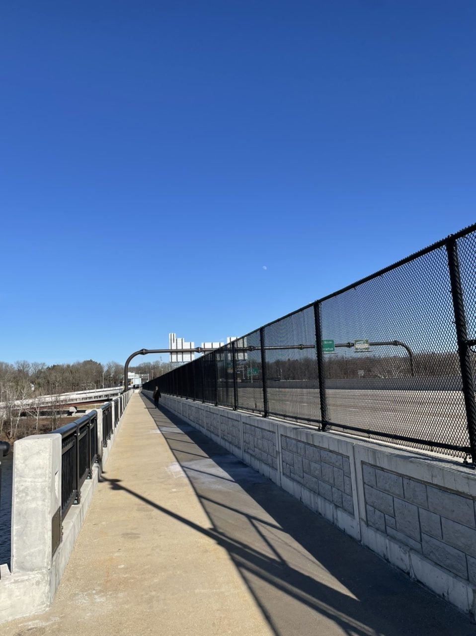
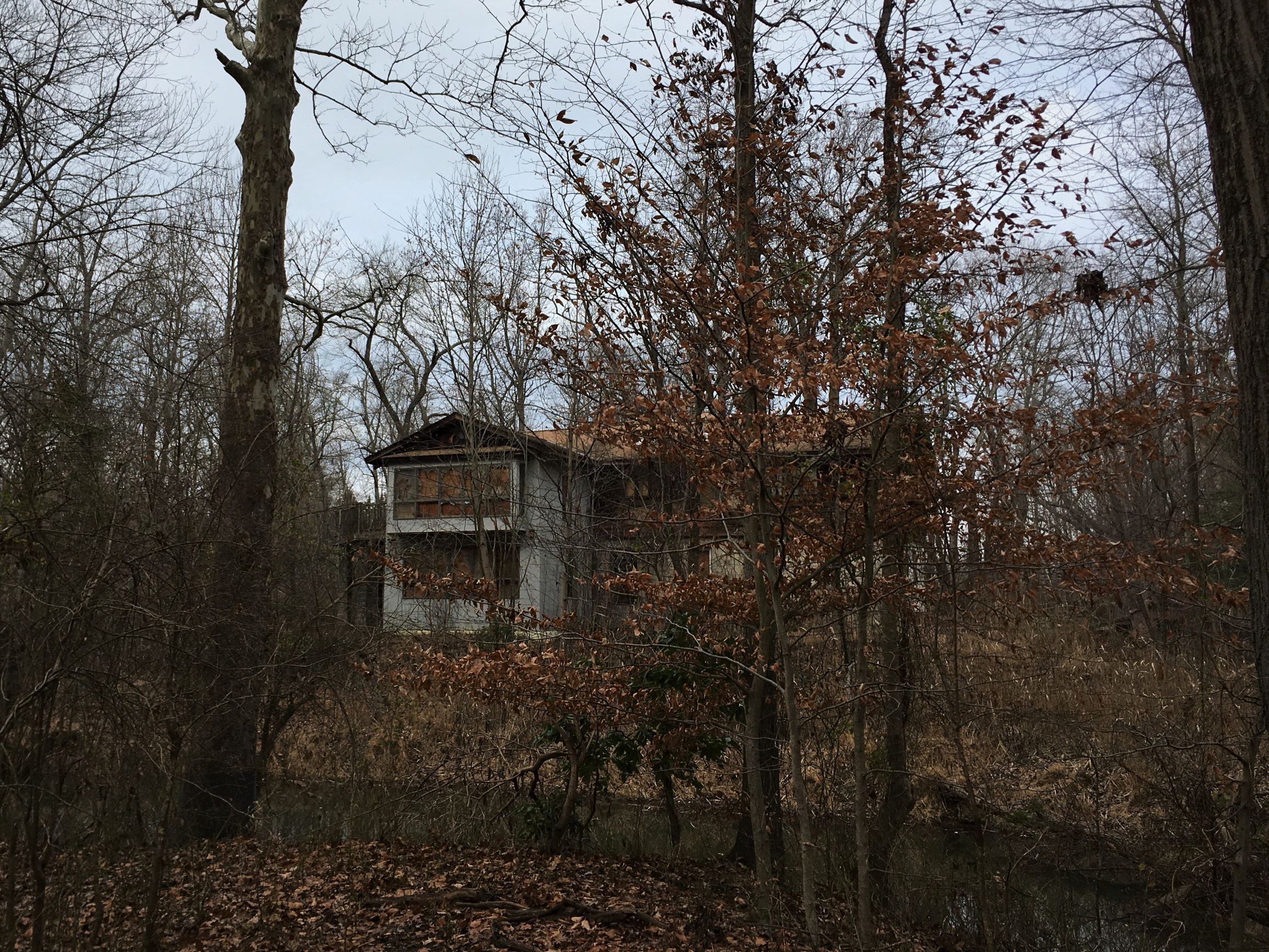
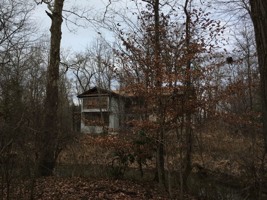
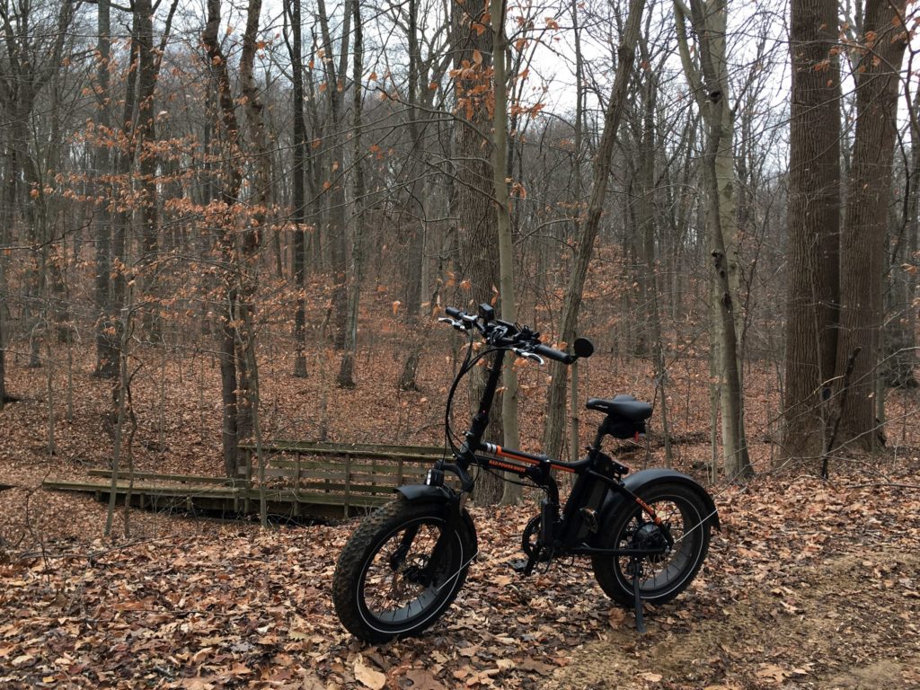
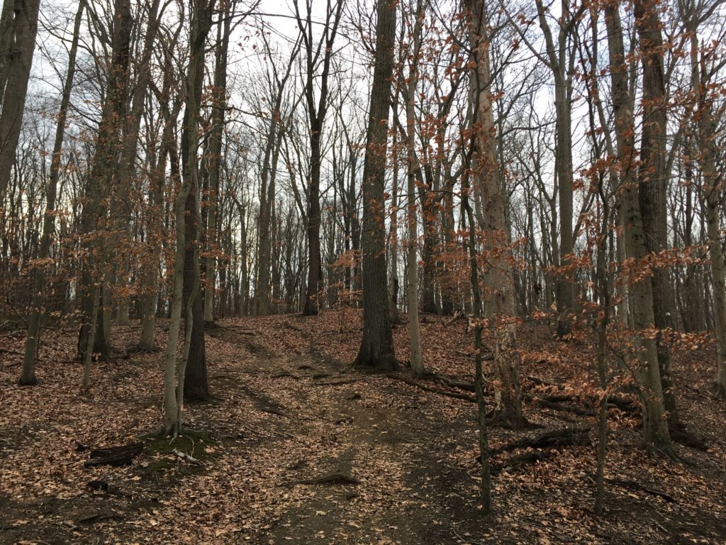
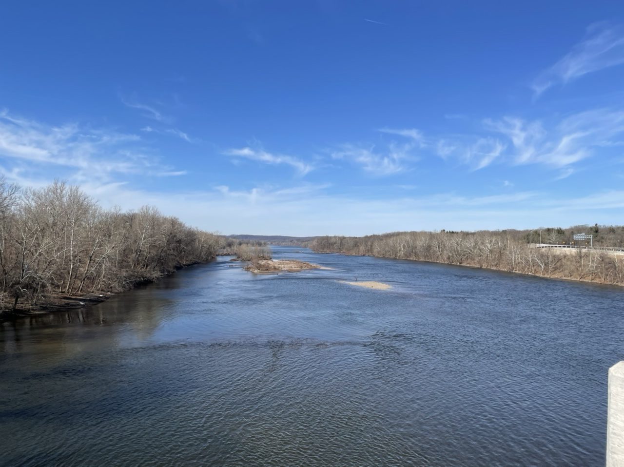
On the first warmish day in a while, I took the Radmini to check out a new river crossing. Beginning on the Delaware and Raritan Canal at Scudder Falls in New Jersey, I rode up the brand new ramp to the 10 feet wide multi-use path on the new Scudder Falls Bridge, which carries I-295 over the Delaware River to Pennsyvlania. The first span of this bridge opened in July 2019. The old bridge (which had opened in 1961) was then demolished and construction began on the second span, which was completed a year later. The shared pedestrian/bicyclist path then opened this past November.

6.72 miles

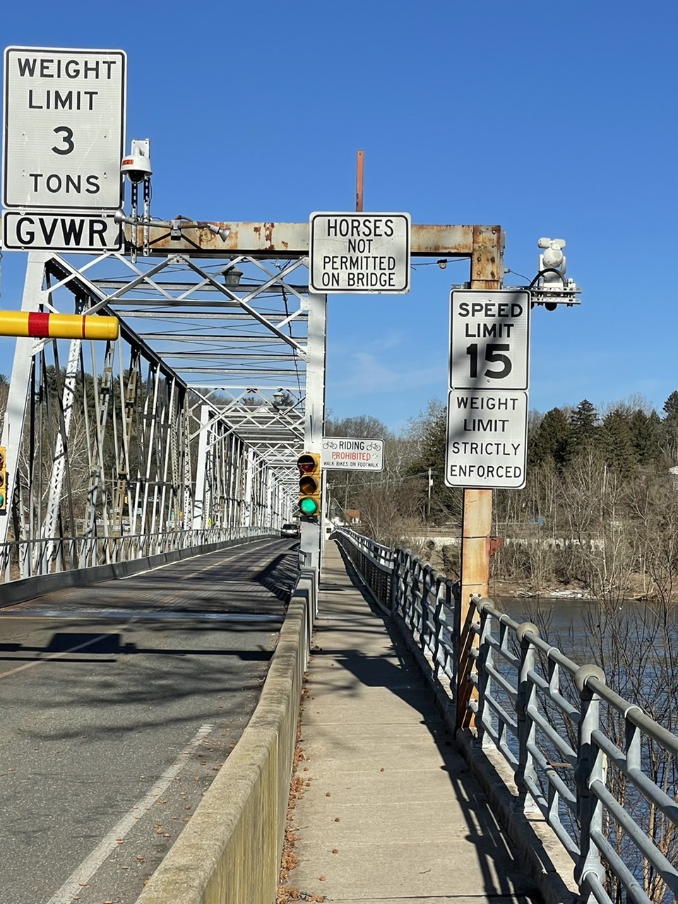
The overpass was busy with with other bikers, walkers, and a few dogs. Coming off the bridge into Pennsylvania, I turned north up the Delaware Canal towpath to Washington’s Crossing. I crossed back into New Jersey on the old and narrow Washington’s Crossing bridge. The piers that support this bridge date back to 1831, while the superstructure was built in 1904. Each car lane is only 7.5 feet wide (so, 2.5 feet narrower than the bike/walk path on the new bridge). After that, it was a quick ride up the D&R canal to my starting point.

Wide enough to ride your bike

Radmini on the bridge
The Delaware Canal in Pennsylvania
Walk your bike
A narrow bridge
Looking downstream. Is that a new bridge in the distance?

Vanished Springs and Wells of New York City

Around the turn of the last century, James Reuel Smith documented and photographed the natural springs and wells of New York City. Why? Well, he was born into a wealthy family and was clearly interested in fresh water.

Most were in the northern part of the city where there was less development and drinking water piped in through the Croton Aqueduct was not as readily available. Smith rode his bike to these locations, and that’s presumably his ride in the photo below, taken in 1897. His kit includes a couple of leather bags attached to the bike frame as well as a rear rack, perhaps used to hold his camera. You can see a communal tin cup hanging on a branch of the tree growing next to the spring, as well as the flat rocks laid around the spring opening.

Gun Hill Spring on Mosholu Parkway near Van Cortlandt Park, Bronx, New York City, September 15, 1897. James Reuel Smith Springs and Wells Photograph Collection, 1893-1902, New York Historical Society.
Well located at W. 188th Street and Webb Avenue, 400 feet east of Sedgwick Avenue and south of Webb Academy, Bronx, New York City, October 3, 1897. James Reuel Smith Springs and Wells Photograph Collection, 1893-1902, New York Historical Society.

Smith’s interest in water sources was not limited to New York. In 1922 he published Springs and Wells in Greek and Roman Literature, their Legends and Locations. Springs and Wells of Manhattan and the Bronx: New York City at the End of the Nineteenth Century was published posthumously in 1938.

E-Biking the Forbidden Drive

As in, you are forbidden to drive a car on it, but you can bike, walk, or ride a horse on it. The former Wissahickon Turnpike, the main drag through Wissahickon Valley Park in Philadelphia, was built in the 1820s and got its current name in the 1920s when it was closed to vehicles.

Wissahickon Creek. Source: TCM

On a pleasantly cool weekend morning there were a lot of people in the park, meaning we had to drive around a bit before finding a parking spot. The gravel path is wide and the people spread out so it was a leisurely 8 mile ride.

Some nice Parkitecture in Wissahickon. Source: TCM
Philly’s first public drinking fountain, built 1854 and shut down in 1957 due to water pollution. Source: TCM

E-Bike to Hanover Pond at Whitesbog

Radmini at Whitesbog
Cranberry bog
Hanover Pond on Gaunt’s Brook. Source: TCM

My first time biking at Whitesbog, the birthplace of the blueberry, was almost a year ago. Today was hotter and the water in Hanover Pond and the cranberry bogs looked very inviting.

As peaceful as it is, Hanover Pond is part of what has been called a “highly engineered agricultural water supply system” for growing cranberries. Whitesbog was already a large, established cranberry operation when Gaunt’s Brook was dammed in 1896 to create Hanover Pond. Water from the pond is channeled into Whitesbog’s Upper Reservoir, built around the same time.

Bog pond at Whitesbog. Source: TCM

Around Port Mercer by E-Bike

Port Mercer was a small town along the Delaware and Raritan Canal in central New Jersey. Since the canal closed down in 1932, commerce has shifted east to U.S. Route 1, where shopping malls, car dealers, and restaurants are now located. On the west side of the canal, there are still extensive swampy wetlands between Lawrence Township and Princeton.

Source: TCM

One of the buildings that remains from the canal’s heyday is the Bridge Tender’s House – the worker who lived there was responsible for swinging open the bridge when a canal boat came through. Several similar buildings still exist along the canal.

Bridge Tender’s house at Port Mercer, NJ. Source: TCM

E-Biking Crystal Lake on Friday the 13th

Source: TCM

Serendipitous is not the right word to use when you find yourself riding your bike alone in the woods around Crystal Lake on Friday the 13th. Fortunately, this was not Camp Crystal Lake, the stomping grounds of infamous axe-murderer Jason Voorhees. That’s up in north Jersey.

This Crystal Lake Park is near Bordentown in central Jersey. The park is mostly farm fields, with some steep wooded areas along the bluff overlooking Crystal Lake. To get to the park, you do have to drive down Axe Factory Road. I saw no actual axe factory, nor, I’m happy to say, any axe-wielders.

Into the Woods.
Source: TCM
Source: TCM

E-Biking the Pole Farm

About 10 miles wandering around Mercer Meadows (a.ka. the Pole Farm) and Rosedale Park.

RadMini e-bike in front of Last Pole Standing
The RadMini in front of the Last Pole Standing at Mercer Meadows. Source: TCM
Metal Arches in a Park
AT&T Building One was where radio technicians connected telephone calls from the U.S. to the rest of the world. The arches show where the entrances to the building used to be. Source: TCM

More Bogs, More Barrens

At the Cranberry Bogs along Mt. Misery trail. Source: TCM

Fall colors are appearing in the Pine Barrens. I rode about 10 miles on parts of the Mt. Misery trail and Glass House Road in Brendan Byrne State Forest, which provide a mix of paved roads, wide graded sand roads, and single track closely hemmed by bushes and trees. I must have been the first visitor that morning, because I was constantly riding through webs spanning the trail and when I stopped for a bit, there were at least three spiders still hanging on to the front of my bike.

The RadMini alongside the bogs. Source: TCM
Sand road along cranberry bog
Riding through the cranberry bogs in Brendan Byrne State Forest. Source: TCM
cranberry bog
Another view of the bogs. Source: TCM

Near the end of the ride, the Reeves cranberry bogs provided a peerless photographic opportunity. The bogs were created by William H. Reeves at the beginning of the twentieth century and remained in operation for at least half a century.

The roads around the bogs had some soft sand. The RadMini did not seem to have a problem with it, but I did almost wipe out plowing through a turn a little too fast.

Sand road blocked by water
Time to turn around. Source: TCM