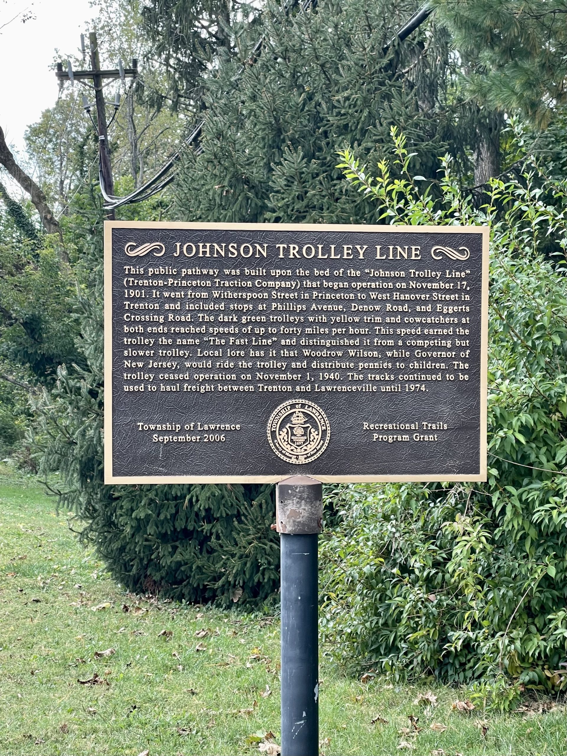
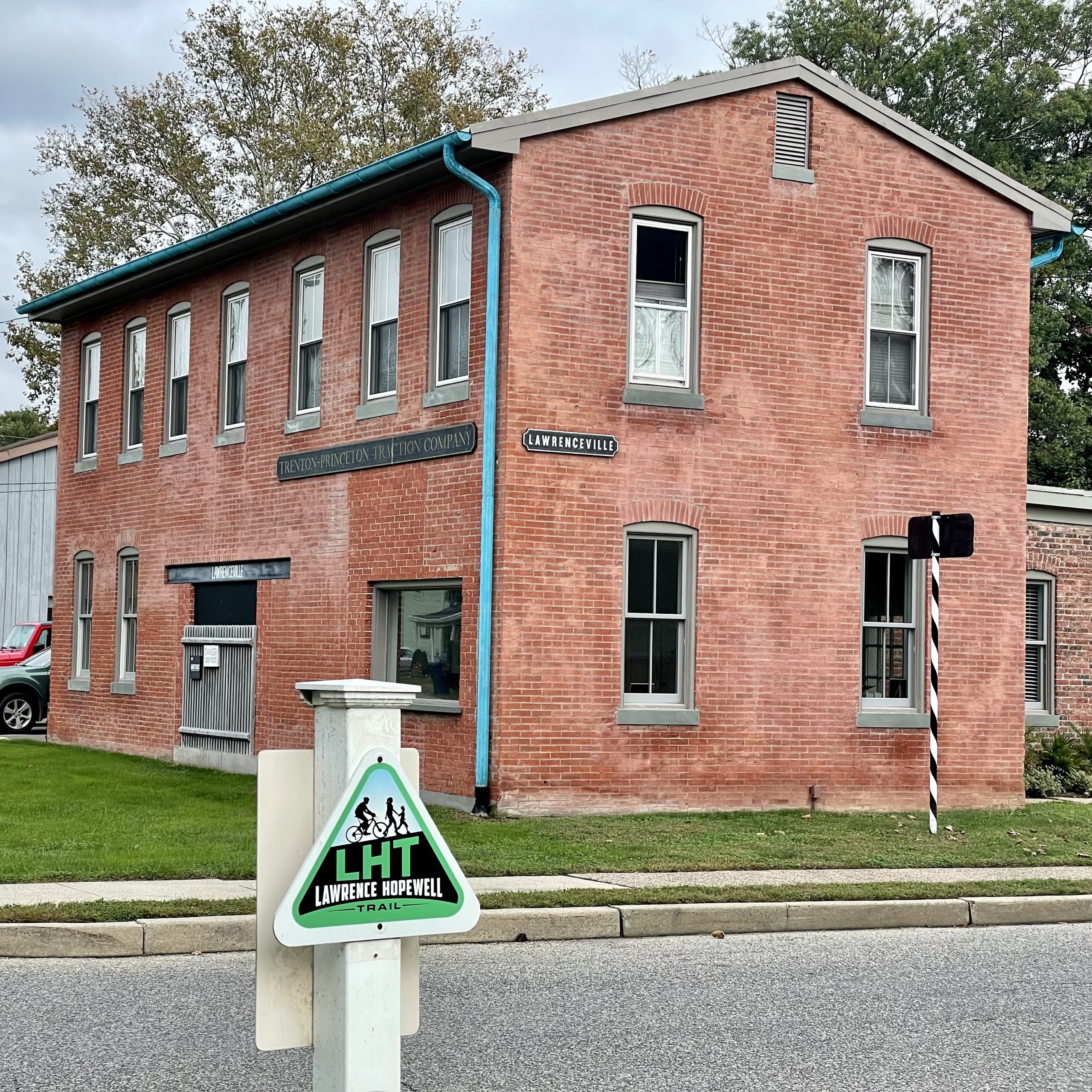
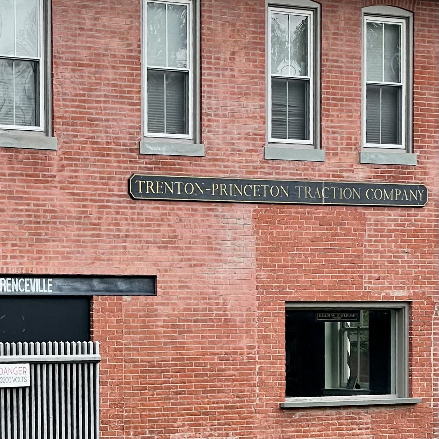
From 1901 to 1940, the Johnson “Fast Line” electric trolley (a.k.a. the Trenton-Princeton Traction Company) carried passengers from Trenton to Princeton.
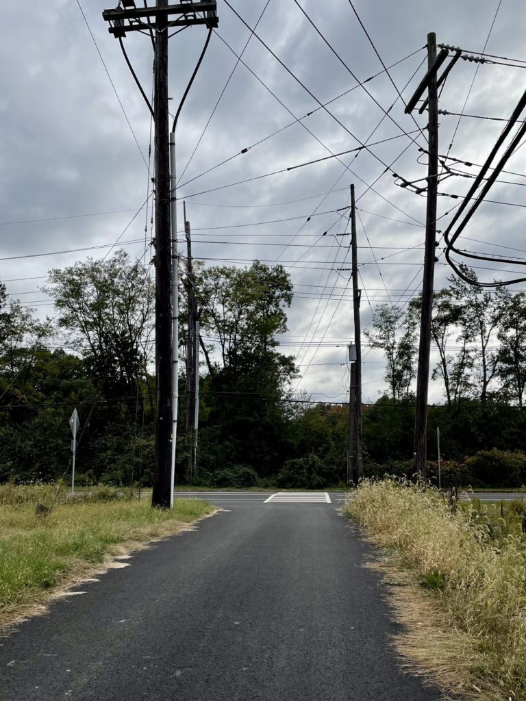
So far, only about three miles of the former 15-mile-long route has been turned into a bike and walk path. The trail is currently split into two sections, bisected by Interstate 295, with no good way to get over it on foot or bike. Perhaps in the future the two segments will be connected.
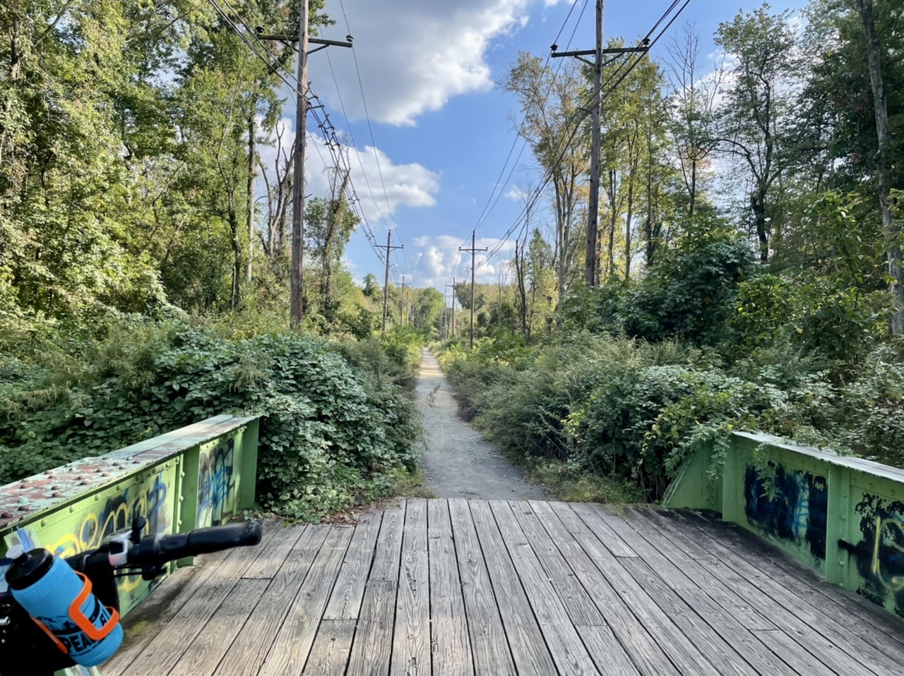
The southernmost section is riddled with large holes and uneven surfaces, with wetlands and woods on either side. Even though warehouses and parking lots are nearby, it feels more wild. Traveling north, the trail becomes more civilized before petering out near the athletic fields of Rider University and the highway.


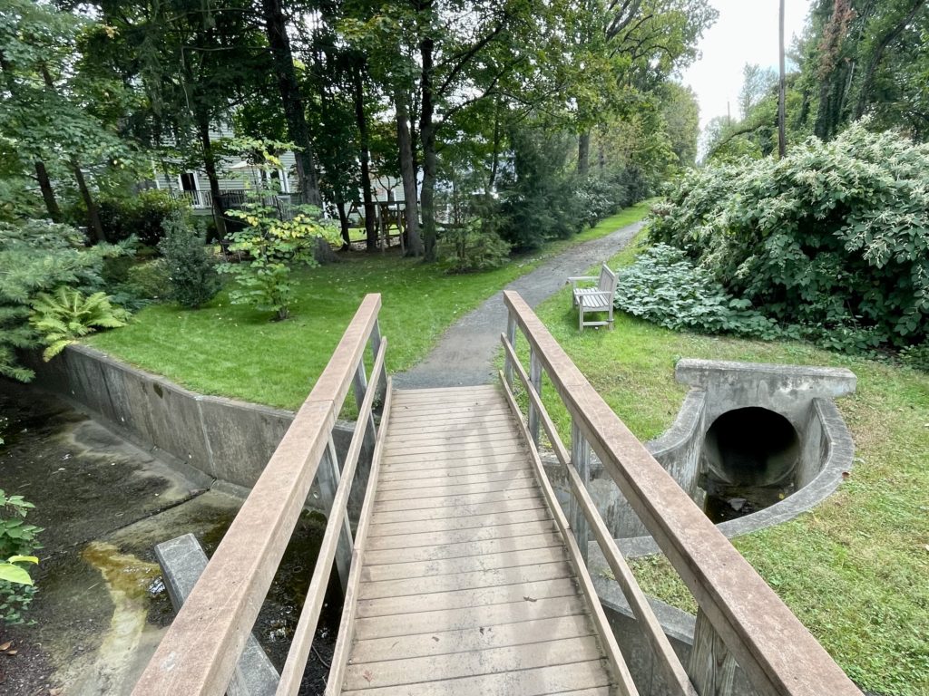
North of the interstate, the trail runs through suburbs before entering Lawrenceville. Here, it crosses, but is not part of, the Lawrence-Hopewell trail. At the end of the Johnson trail is the former office of the Johnson Ferry, which has been restored (with reproduction signage).

Fantastic! Thanks! I myself have driven over parts,near the NJ college, walked over quite a lot, getting pictures of all the bridges I found so far and from the Trenton library, gotten copies of the Sanborn maps they have from 1955! I also have a Trenton and Princeton Traction co book!
Sanborn maps are a great resource.