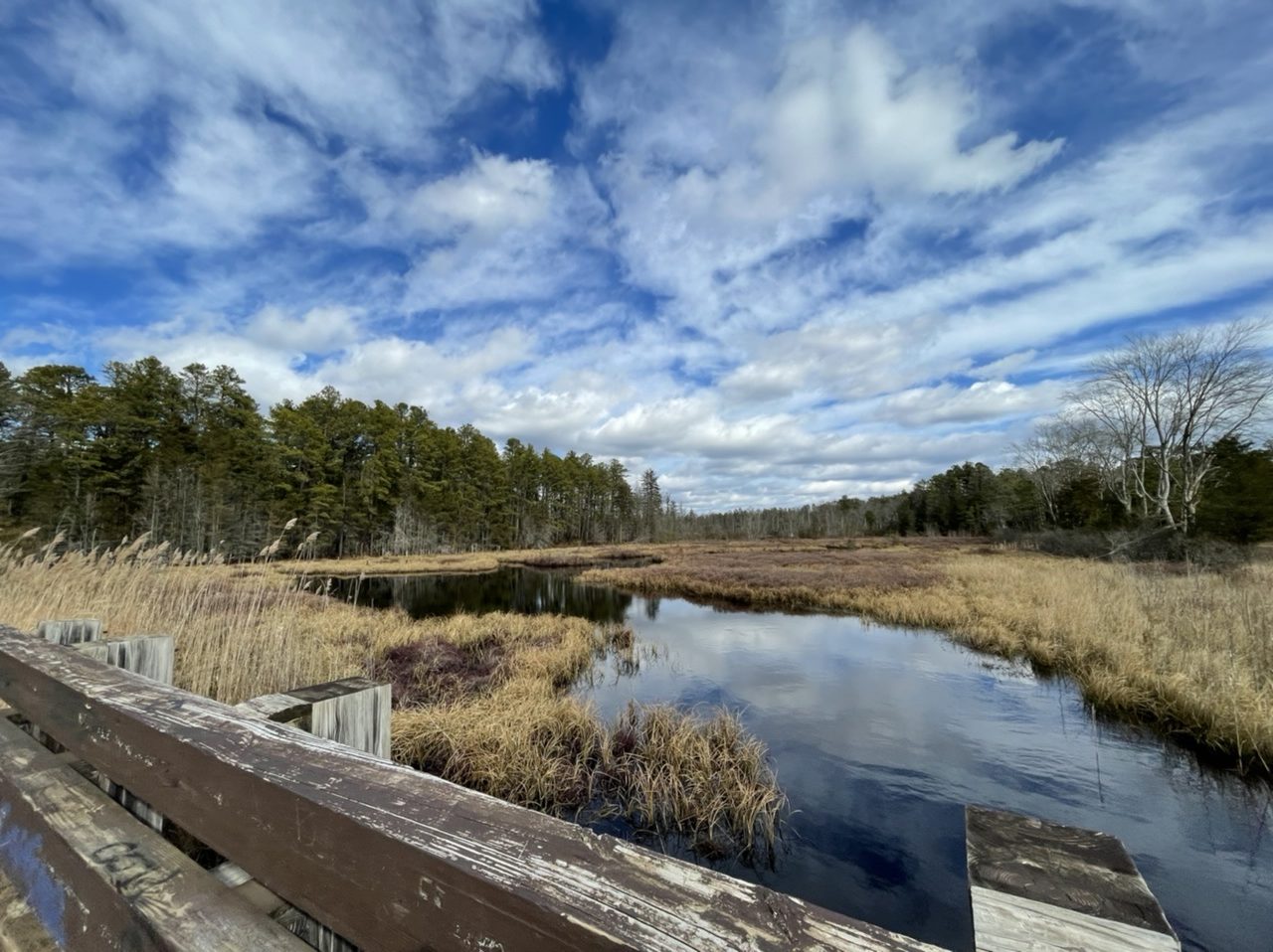
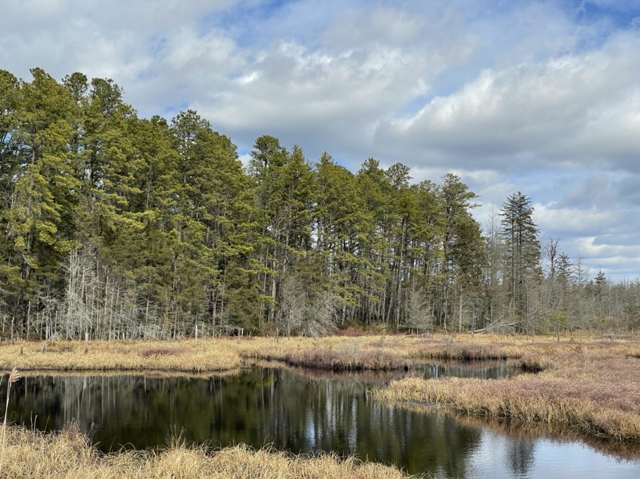
Just Another Pine Barrens Pond
You begin to interest me…vaguely
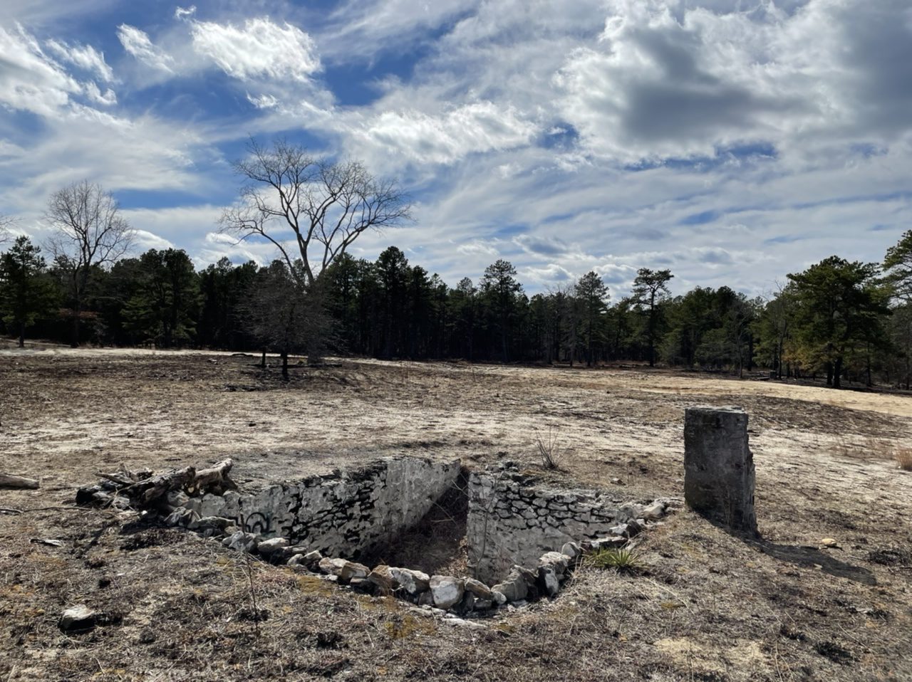
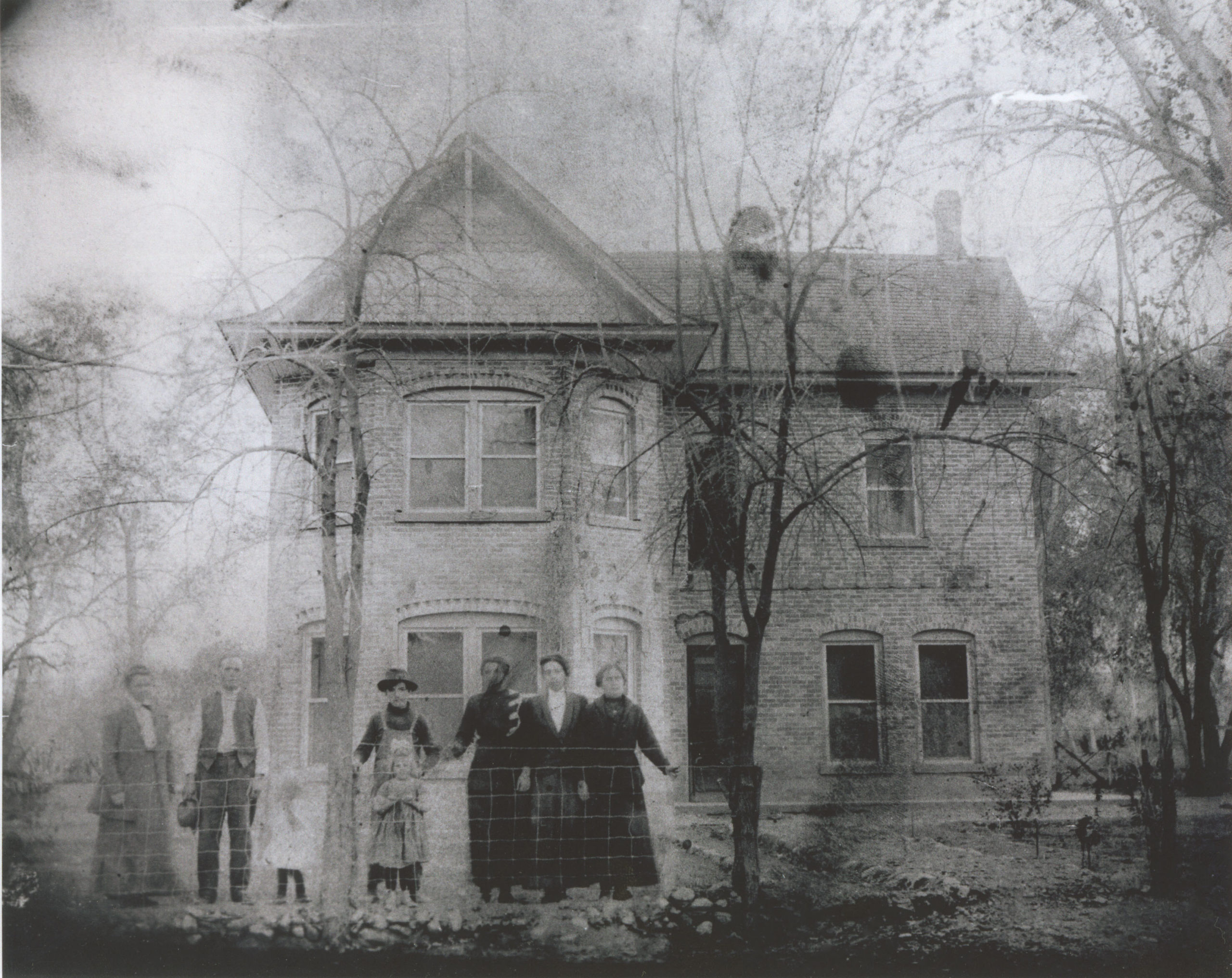
Speaking of ghost towns, Friendship is one of many abandoned towns in the New Jersey Pine Barrens. It was founded around the 1860s as a cranberry farming town. Cranberry packing finally ended around 1960 or so, and at least some people were still living here into the 1970s. The cranberry bogs are still here.
Coincidentally I visited here about a week after controlled burning by the New Jersey Forest Fire Service, so it was much easier to see many of the old building foundations.


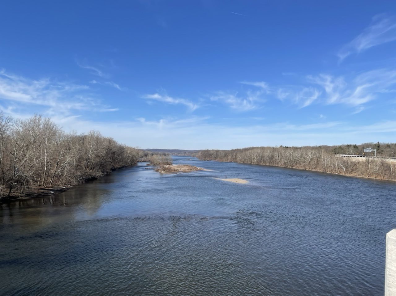
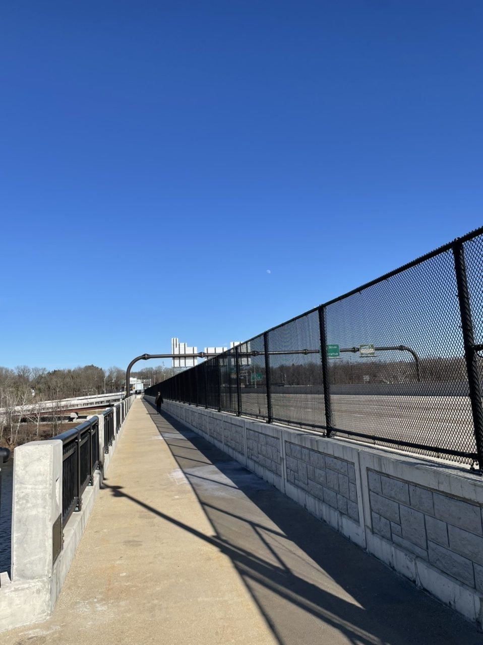
On the first warmish day in a while, I took the Radmini to check out a new river crossing. Beginning on the Delaware and Raritan Canal at Scudder Falls in New Jersey, I rode up the brand new ramp to the 10 feet wide multi-use path on the new Scudder Falls Bridge, which carries I-295 over the Delaware River to Pennsyvlania. The first span of this bridge opened in July 2019. The old bridge (which had opened in 1961) was then demolished and construction began on the second span, which was completed a year later. The shared pedestrian/bicyclist path then opened this past November.

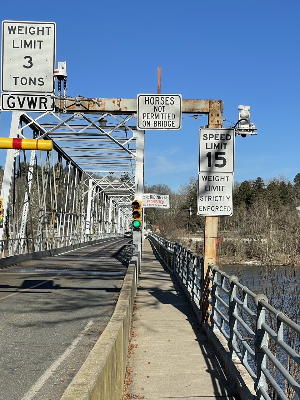
The overpass was busy with with other bikers, walkers, and a few dogs. Coming off the bridge into Pennsylvania, I turned north up the Delaware Canal towpath to Washington’s Crossing. I crossed back into New Jersey on the old and narrow Washington’s Crossing bridge. The piers that support this bridge date back to 1831, while the superstructure was built in 1904. Each car lane is only 7.5 feet wide (so, 2.5 feet narrower than the bike/walk path on the new bridge). After that, it was a quick ride up the D&R canal to my starting point.


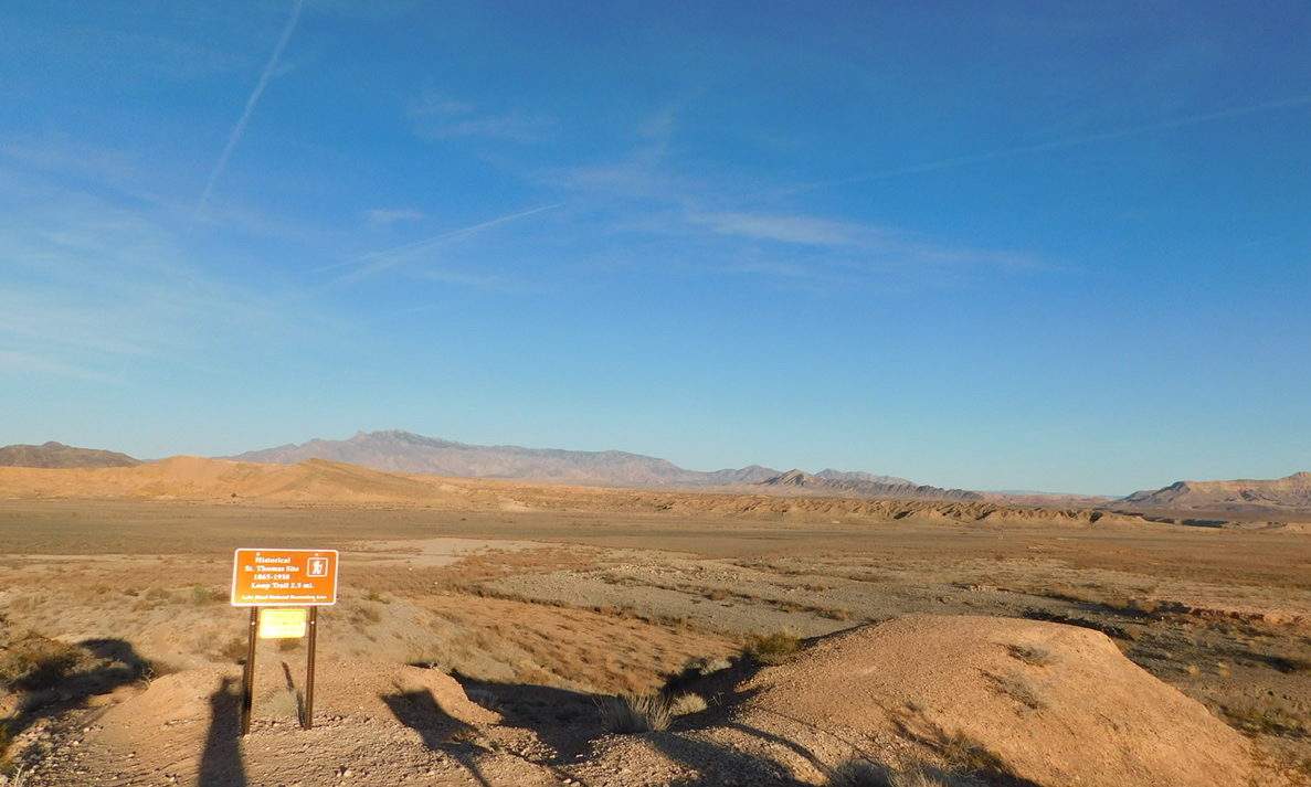
The town of St. Thomas, Nevada, was settled by Mormons in 1865. On August 31, 1869, John Wesley Powell’s First Colorado River Expedition, which culminated in the first recorded passage by raft through the Grand Canyon, came to an end about twenty miles from here. Bishop Leithead of St. Thomas, informed that Powell had, in fact, survived his expedition, rode to meet him. “Bishop Leithhead,” Powell wrote, “brings in his wagon two or three dozen melons, and many other little luxuries, and we are comfortable once more.”
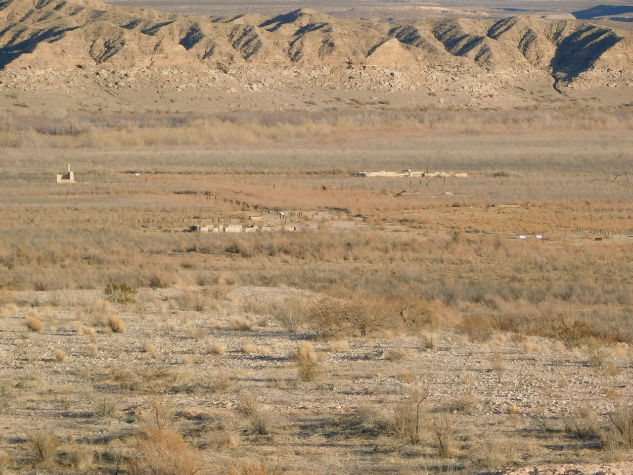
Only two years later, most of the original settlers left due to a dispute over taxes. Other people later moved in and at its peak, the town had over 500 citizens. When Hoover Dam was built in the 1930s, the government bought out the residents. The last person left in 1938 as the town was inundated by the rising waters of the newly-created Lake Mead.
In wetter times, the site lay under 60 feet of water. As lake levels receded with the ongoing drought of the 21st century, the remains of the town have been exposed again.

To get to St. Thomas, you turn off of Northshore Road and drive 3.5 miles down a rocky dirt road. There’s a parking area, from which you can head down hill to a 2.5 mile hiking trail. We arrived late on a December afternoon and had someplace else to get to before nightfall, so only had time to view the building foundations from a distance.


Reference:
John Wesley Powell, 1875. Exploration of the Colorado River of the West and its tributaries. Explored in 1869, 1870, 1871, and 1872, under the direction of the secretary of the Smithsonian institution. Government Printing Office, Washington.
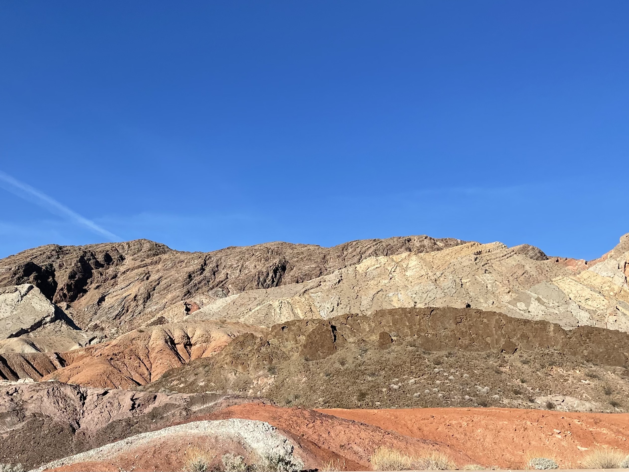
Northshore Road runs along, yes, the north shore of Lake Mead. The shoreline itself is now far east of the road because of long-term drought in the region. Coming west from Hoover Dam, we turned onto it near Lake Las Vegas and drove it up to Valley of Fire, stopping several times along the way.