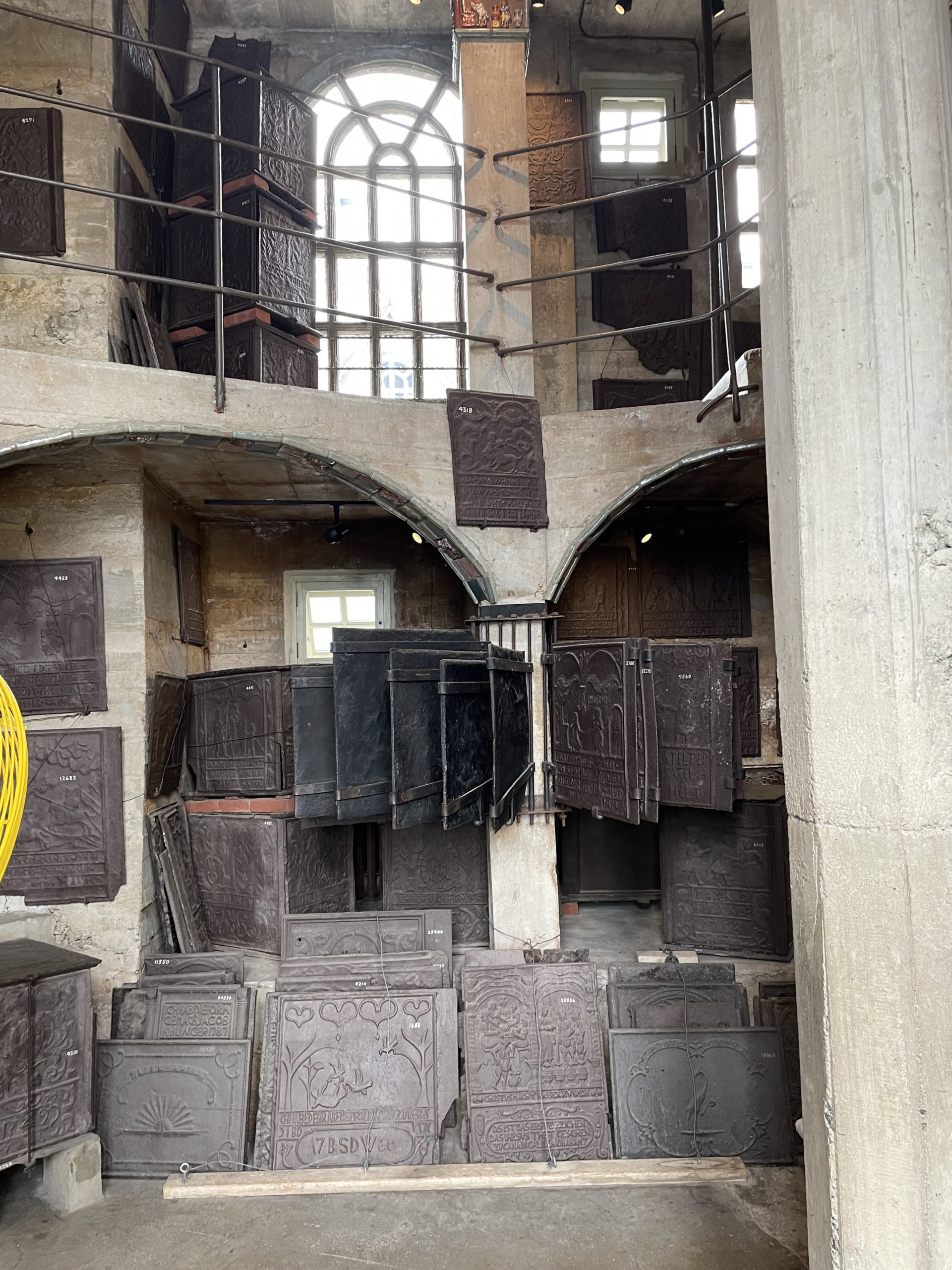
This museum in Bucks County, Pennsylvania, is housed in a concrete castle designed by Henry Mercer, an early archaeologist, collector, and ceramicist. Mercer collected historic tools and other artifacts that demonstrated American industry and crafts, including blacksmithing, butchery, hat-making, and many more.
Cradles and chairs on the ceiling.Butchery and sausage-making tools.Firebacks and more firebacks.Ceramic tiles!
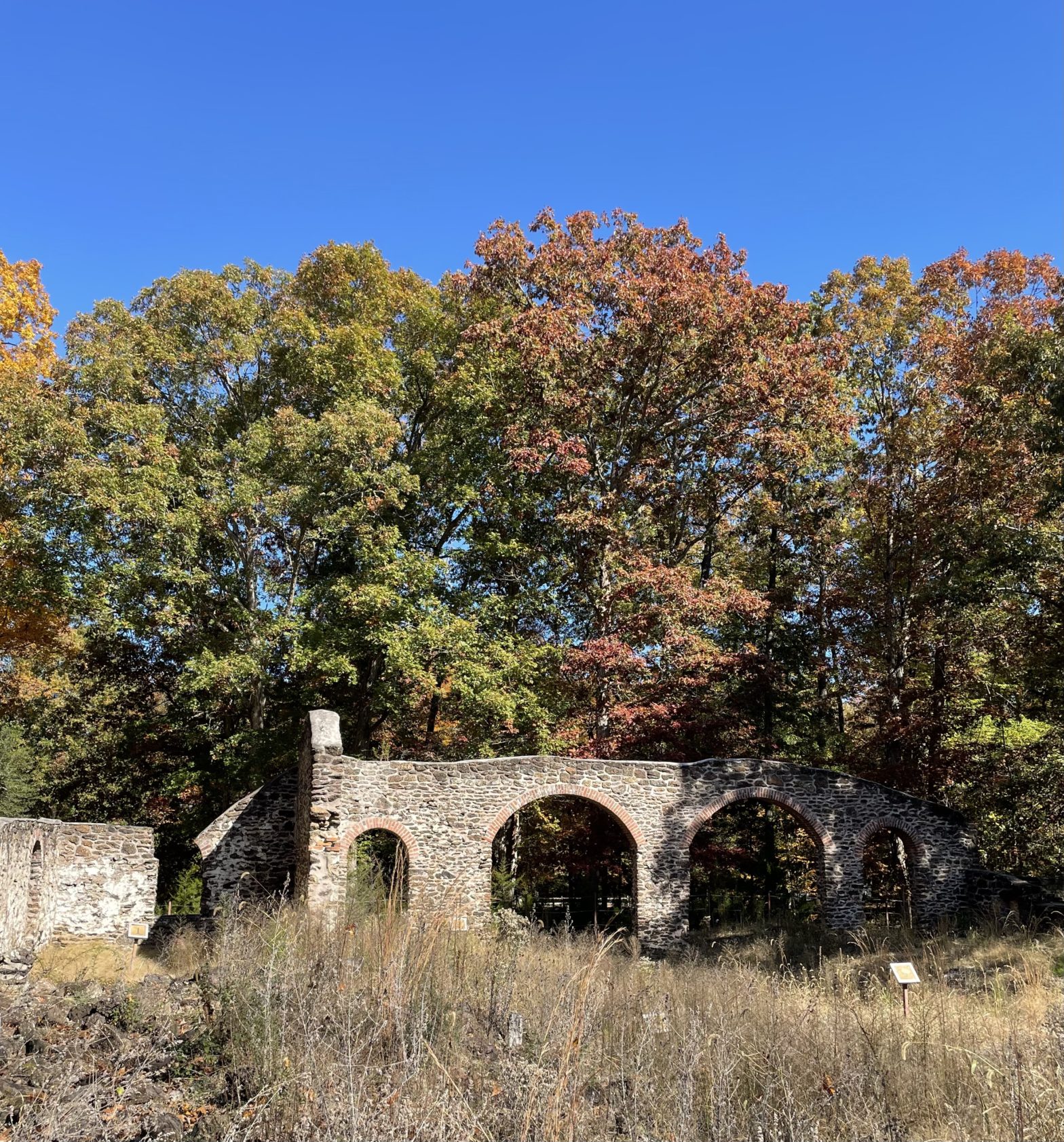
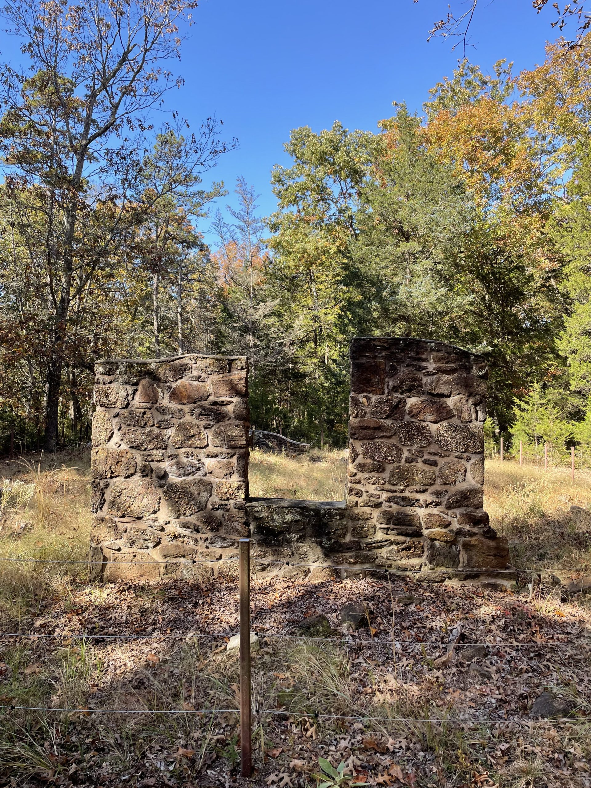
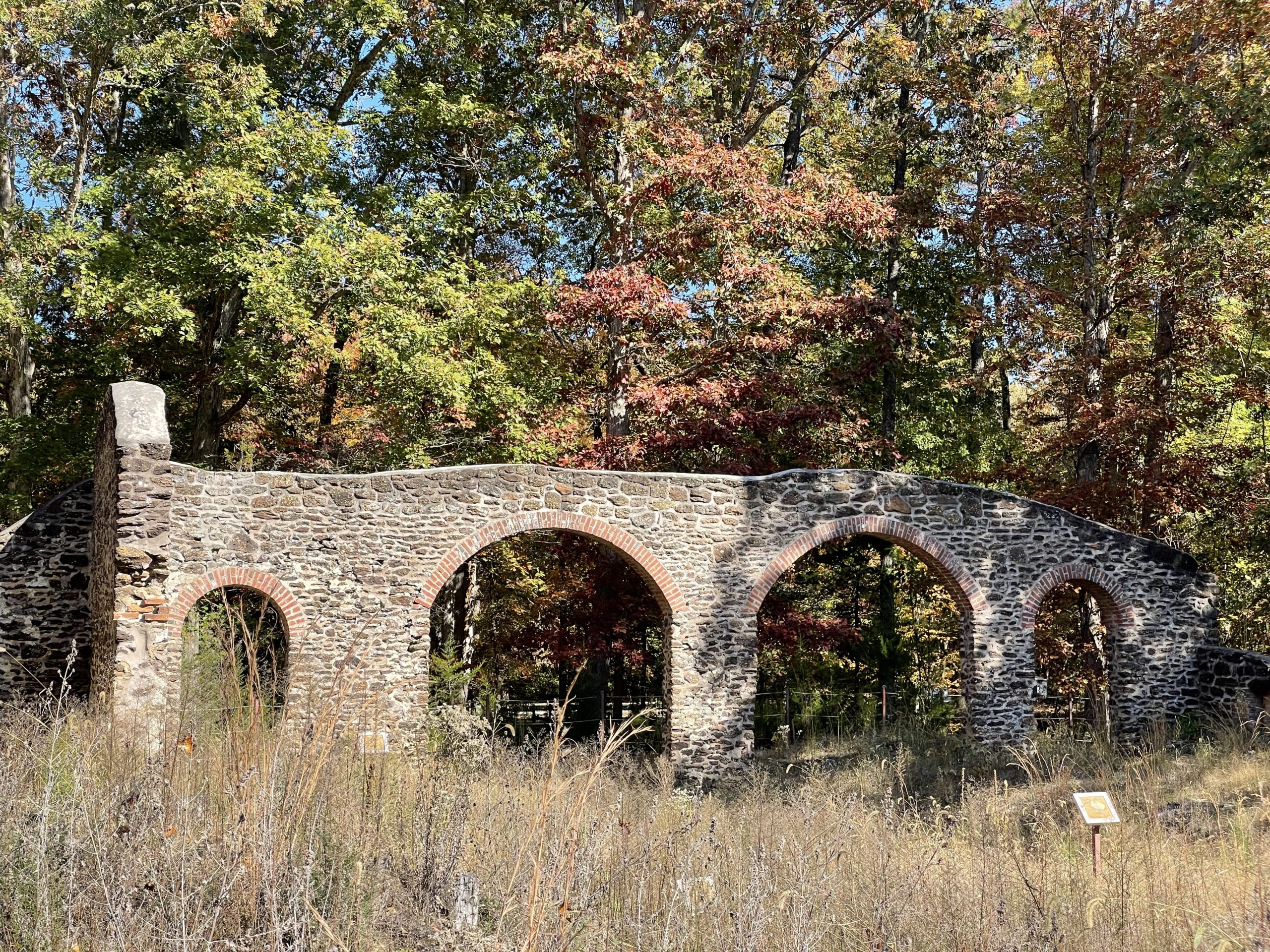
Not far from Atlantic City, New Jersey, are the remains of the nineteenth-century Estellville Glassworks, which was in operation from about 1826 to 1877. These buildings are unusual among New Jersey glassworks in using local sandstone with brick arches. Visited on a balmy Autumn day.
Ruins of the Pot House.Ruins of the Pot House, where the clay crucibles, or pots, were made.Ruins of the Melting Furnace.
What was going on in the world in 1961? A lot of eeriness, a lot of confused, threatened, concealed or failed aggression
Ben Ratliff
Taking inspiration from Coltrane’s two weeks at the Village Vanguard almost exactly 60 years ago, Ben Ratliff in the Washington Post riffs on John Coltrane and the Essence of 1961.
So here was a tendency: self-immersions, burials, entrapments, irritating provocations, projects with a built-in self-destruct button, all in the name of asking a better question. But whenever one proclaims a tendency in culture, one had better be prepared to find the opposite tendency at the same time. Sure enough, one could: plenty of joyous, communal, repetitive music, but similarly intense, and similarly resisting the concept of a leader, or a hero.
How else are you going to get to Christmas Island?
A free online talk from the The Royal Museums Greenwich will educate you about 400 years of celebrating Christmas afloat. The Zoom lecture is Tuesday 7 December, 5.15pm – 6.45pm (I presume that’s Greenwich Mean Time, so check your time zone).
Focusing largely on British ships, our panel of experts will discuss the experience of spending Christmas at sea from 1600 onwards.
What did sailors and passengers do to mark Christmas? How did eating, drinking, socialising and worshiping differ when done at sea? How did events such as the Interregnum and the Second World War, as well as changing understandings of Christmas, influence the festive season afloat? Was spending Christmas at sea better or worse than spending it on land?
Each panelist will give a short presentation on the experience of spending Christmas at sea in a specific era, before taking questions from attendees. Covering Stuart sailing vessels to warships of the 1940s, this seminar will put the tide back in yuletide.
Featured image (which has no relation to the museum talk): Santa Claus and two assistants in Sarasota, Florida. Photo by Joseph Janney Steinmetz, 1965. www.floridamemory.com Florida State Library and Archives.
The New York State Museum has just published James W. Bradley’s new book, Onondaga and Empire; An Iroquoian People in an Imperial Era. The book is available to freely download from the museum. At over 800 pages, it is a truly massive work and focuses on the Onondaga Iroquois and their interactions with Europeans over a fifty-year time span (c. A.D. 1650-1701).
Lamoka is a word that you don’t see used much other than for the lake itself, and the prehistoric archaeological culture found along its shores. Does anyone know where its name came from?
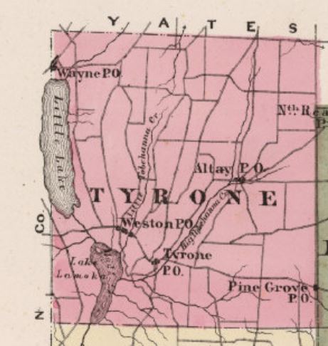
On early maps, including the 1829 Atlas of New York and the 1869 New Map of the State of New York, Lamoka is named Mud Lake, and Waneta Lake to the north is called Little Lake. By 1874, in an atlas of Schuyler County (see more of the 1874 Atlas here), Lamoka Lake appears on the map, although Little Lake is still used for Waneta. In the 1879 book History of Tioga, Chemung, Tompkins and Schuyler Counties, New York, “Lamoka” is used repeatedly, and Little Lake has become “Wanetta.”
1874 Map of Schuyler County.
I’m not surprised they changed the name – there are at least 30 other Mud lakes in New York, and Lamoka has a nice sound to it—but I’d like to know where they got the name from.
If anybody knows, or has any clues, please leave a comment!
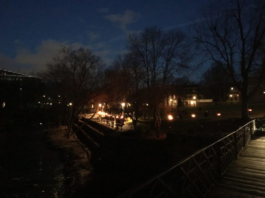
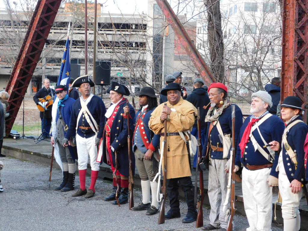
Scenes from the first Assunpink Firewalk, part of the City of Trenton’s Patriots Week, which celebrates George Washington’s revolutionary victories at the Battles of Trenton.
Assunpink Firewalk, Trenton, NJ. Source: TCM
THESE are the times that try men’s souls. The summer soldier and the sunshine patriot will, in this crisis, shrink from the service of their country; but he that stands by it now, deserves the love and thanks of man and woman. Tyranny, like hell, is not easily conquered; yet we have this consolation with us, that the harder the conflict, the more glorious the triumph.
Thomas Paine, The American Crisis, 1776
The Firewalk was held along Assunpink Creek, near where American soldiers repulsed three British attacks at the second battle of Trenton on January 2, 1777.
Source: TCM
After night fell, Washington left a rearguard to light campfires and fool the British into believing the Americans were holding their positions. In actuality, the American troops were marching away. The next day, Washington would win another victory at the Battle of Princeton.
The Firewalk included the lighting of 13 torches, symbolizing both the 13 colonies and the fires lit by the Americans to cover their retreat, and a reading of Thomas Paine’s The American Crisis, written on December 23, 1776, and read to American troops before the first battle of Trenton.
Paramaribo, Willemstad: detail of Antenna map at the Pole Farm, Mercer Meadows.
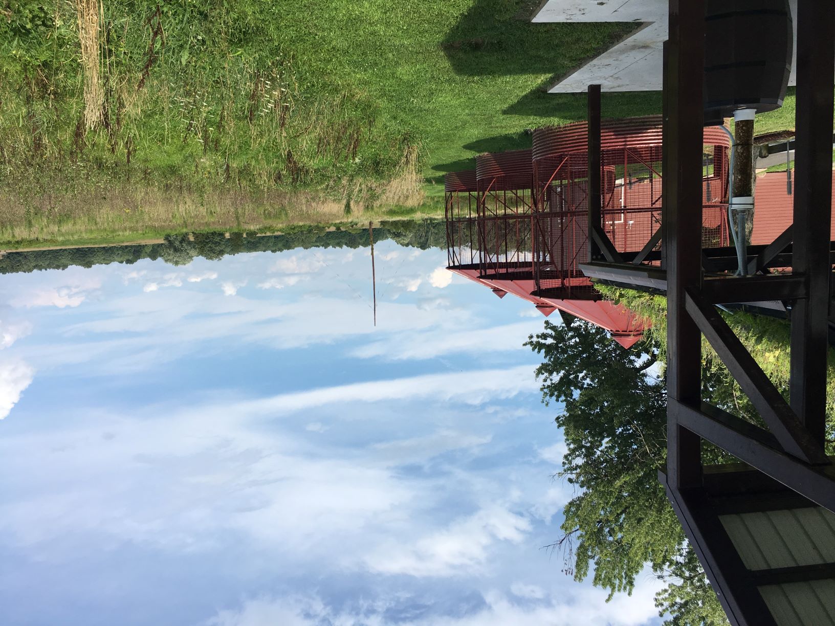
Last Pole Standing, viewed from the Reed/Bryan farm.
The original telephone system connected phones by copper wire strung up on poles. These “land-lines” faced a problem when confronted with obstacles like the Atlantic ocean, so it was not possible to connect the phone systems of distant countries. In the 1920s, AT&T developed a way of using short wave radio to transmit telephone signals over long distances without wires. In 1928, AT&T bought several farms in Lawrence, New Jersey, cleared the land, and began building a vast antenna array for trans-Atlantic telephone calls. The facility, officially called the American Telegraph & Telephone International Radio Telephone Transmission Station, was only responsible for calls originating in the United States. A separate facility in Netcong, New Jersey, received incoming calls from overseas.
The Lawrence station became known as the Pole Farm because the rhombic antennas that AT&T installed at the site were arranged in a diamond-shaped pattern on wooden poles up to ten stories tall. Each antenna covered 10 acres and connected New Jersey and the rest of the U.S.A. with a single city in Europe, North Africa, the Middle East, or South America. Hundreds of these poles were arranged over the 800 acre facility. Open areas between the poles were leased to farmers, who had to plow around the many antennas.
Fewer than 50 calls were made on an average day in 1929, in part because a three-minute call to England cost over thirty dollars. The station, however, allowed almost instantaneous communication across the Atlantic Ocean (once trained telephone operators had arranged the connection). By the 1960s, however, international calls were more affordable and over 16,000 telephone calls were transmitted daily through the Pole Farm.
The Pole Farm shut down in 1975, replaced by undersea cables and satellites. Where once there were hundreds of wooden poles, there is now only one. That pole, which once transmitted phone calls to Israel, survived because the farmhouse next to it used it as a lightning rod.
The last pole.
Two buildings, imaginatively named Building One and Building Two, bracketed the antenna field. Both buildings have been demolished, but a memorial to the facility, built over Building One, includes a large concrete and stone map set into the ground, showing the layout of the antennas around the time of World War II. Each antenna is labeled with the city to which it transmitted phone calls.
Berlin, Reykjavik, Moscow, London: detail of Antenna map at the Pole Farm, Mercer Meadows.
The Pole Farm is now part of the Mercer Meadows county park and features restored grasslands, nature trails, and interpretive signs.
Reference:
Yearley, Alexandra
2013 “Pole Farm” remembered in Mercer Meadows plans. https://communitynews.org/2013/02/01/pole-farm-remembered-in-mercer-meadows-plans/