Who Really Discovered the First Paleoindian Sites in Vermont?

In 1927, the Folsom site in New Mexico, which contained the distinctive fluted stone points of the same name directly associated with an extinct species of bison, was identified by archaeologists as the first Paleoindian site. In conjunction with the similar, but earlier, Clovis fluted points found at Blackwater Draw a few years later, these two sites provided clear evidence that humans had been present in the United States since the end of the Pleistocene.

As these discoveries became publicized and archaeologists looked for more examples of early sites, it soon became apparent that fluted points had been found in many states by amateur antiquarians, often as surface finds. Without good contextual data, however, no one had realized how old these points actually were.

In 1929, Vermont collector Benjamin Fisher read an article about the Folsom site in the New York Herald Tribune. He immediately wrote a letter to the scientist mentioned in the paper, Barnum Brown, at the American Museum of Natural History:

Coffeehouse Archaeology in England

Artifacts from the Claphams Coffeehouse assemblage. Source: Cressford et al. 2017: Figure 8.

Before England fell in love with tea, there was coffee. Beginning in the 1600s, coffeehouses spread through England. Historians think of them as the more polite, refined counterpoint to taverns and alehouses, a place where the customers – mostly male – could drink and discuss and debate the news of the day.

It’s a bit surprising that almost no coffeehouses have been explored archaeologically, but Craig Cessford and colleagues now describe artifacts, tightly dated to between 1770 and 1780, from a small brick cellar associated with Clapham’s Coffeehouse in Cambridge, England.

Frans Ferdinand Blom: Danish Dixie Bohemian Archaeologist

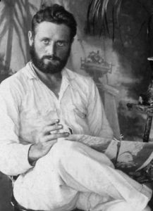
Frans Blom 1922. Source: Bancroft Library, University of California, Berkeley, Public Domain

“My first encounter with a cave filled with human skulls and bones occurred in 1928 at Huxjal.” Frans Ferdinand Blom knew how to start an article. His bio is now up at Jazz Age Adventurers.

The Field Trip that Founded, and Filled, the Oriental Institute

Oriental Institute Building

In 1919, James Henry Breasted, archaeologist and founder of the Oriental Institute at the University of Chicago, embarked on a year-long trip through the Middle East. His goal was to identify research opportunities throughout the area, and to obtain artifacts to bring back to Chicago. The story (from a 2010 exhibition at the Institute) was told in Archaeology Magazine.

Philly Archaeologists’ Map Hopes to Warn Developers Away From Unmarked Cemeteries

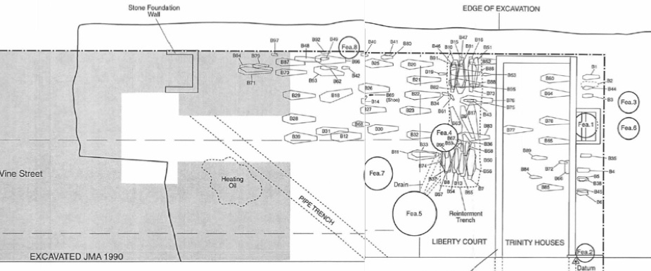
Just one example of the many historic graves uncovered in Philadelphia. Source: phillyarchaeology.net

Nonexistent or weakly enforced laws in Philadelphia have led to historic graves being destroyed by construction. Hastily organized rescue excavations have salvaged some of these human remains, but others have been destroyed, or are threatened by future development projects. In an attempt to reduce the damage to historic cemeteries, archaeologists in the city have produced an interactive map showing where unmarked gravesites and burial yards were located. They caution, however, that the map does not show all historic burial locations, and that even if a historic cemetery is documented to have been relocated at some time in the past, many human remains are likely still present in the original location. Read more about the issues that led to the creation of this map at the Philadelphia Archaeological Forum.

How to Make Battleship Curves

…the old-school way, with paperclips. David Hurst Thomas illustrates:

“Seriation diagrams were once constructed by hand (literally). Frequencies of temporal types were converted to percentages, then drawn on individual strips, which were then moved up or down until they approximated a series of battleship-shaped curves (Ford, 1962: fig.8). This tedious and subjective procedure has since been replaced by computer programs.”

From:
David Hurst Thomas 2008, Addressing Variability in the Pooled Radiocarbon Record of St. Catherines Island, in Native American Landscapes of St. Catherines Island, Georgia. II The Data. Anthropological Papers of the American Museum of Natural History No. 88. Figure 16.9.

previously posted on Adequacy.

Tucson’s Presidio and Historical Archaeology in the 1920s

By digging at the site of the Presidio San Agustín del Tucson in 1929, Engineer Donald Page gets the nod as Tucson, Arizona’s first historical archaeologist. That was his only excavation, and less than ten years later, his life took a tragic/stupid turn (alcohol and a handgun were involved). See Donald Page: Tucson’s Tragic First Historical Archaeologist by Homer Thiel.