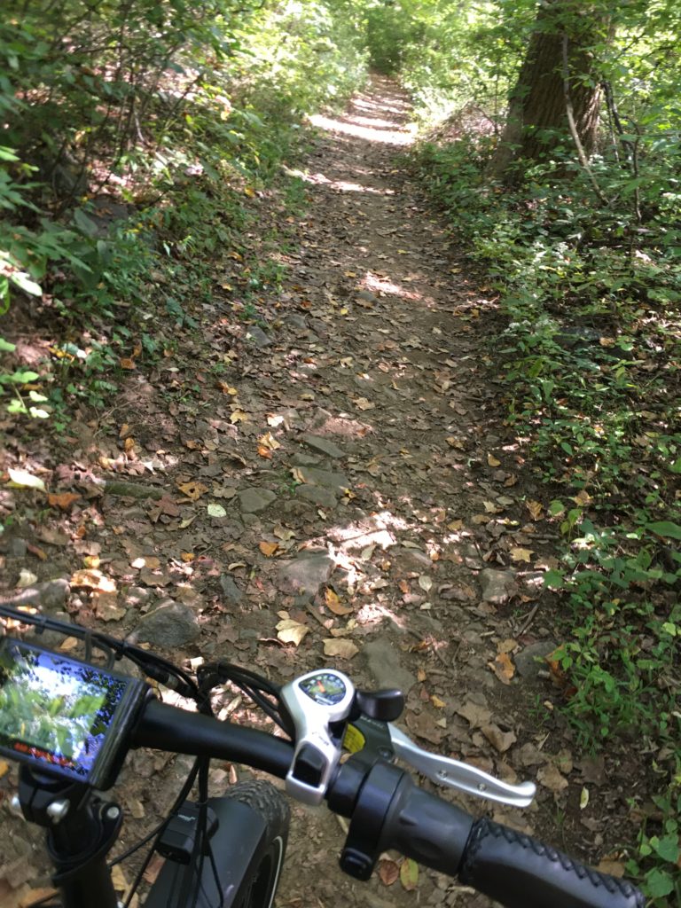
A quick, 5 mile out-and-back ride along the Ridge Trail in the Ted Stiles Preserve at Baldpate Mountain, New Jersey.
You begin to interest me…vaguely
A quick, 5 mile out-and-back ride along the Ridge Trail in the Ted Stiles Preserve at Baldpate Mountain, New Jersey.
The Gold Camp Road runs through the Rocky Mountains south of Pikes Peak in Colorado. For over a hundred years, it has been traveled by tourists, first on passenger trains and later in automobiles. The Colorado Springs & Cripple Creek District Railway was built around the turn of the twentieth century to bring gold ore down from the mines around Cripple Creek and Victor. By the 1920s, the railroad was out of business and the route was soon converted into an automobile toll road for tourists.

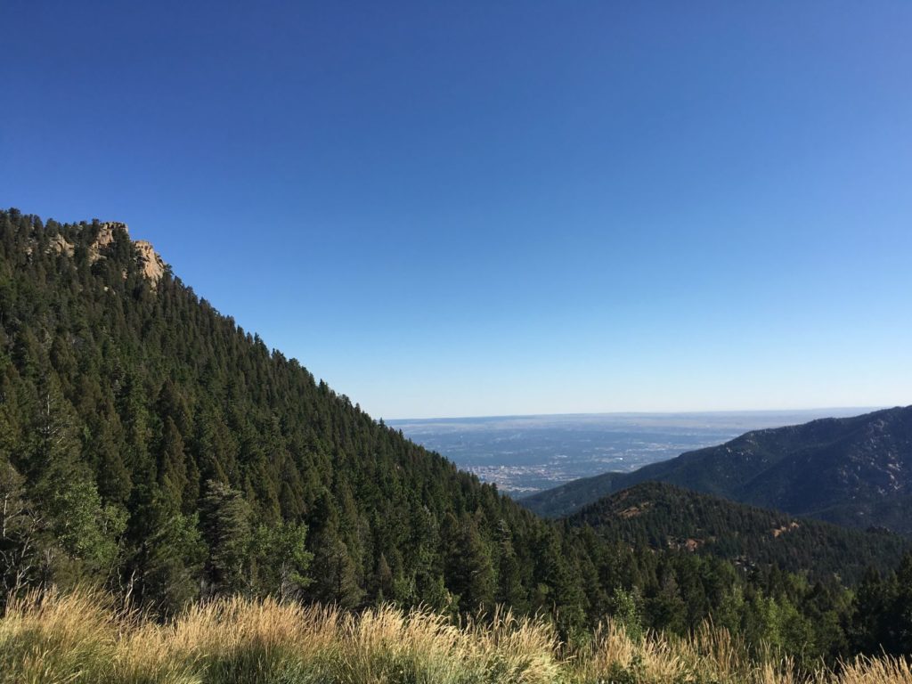
It remains a popular destination. We rented a couple of KHS mountain bikes from Challenge Unlimited and they drove us in their van up the unpaved and potholed Old Stage Road to St. Peters Dome, roughly halfway between Cripple Creek and Colorado Springs. Our driver dropped us off with a couple water bottles, a photocopy of a hand-drawn map, and a little backpack with a pump and repair kit, in case we got a flat tire. From there, it was all downhill.
The first eight miles or so are closed to automobiles, and we were riding on a Monday after the summer tourist season ended, so we had the gravel road to ourselves. We rode through two tunnels, stopping several times to take in the views. After about an hour and a half, we reached Tunnel #3. In 1988, this tunnel collapsed (which is why cars are no longer allowed), so we had to walk the bikes along a trail that goes over the tunnel. Below Tunnel #3 there was a parking lot, cars, and more hikers and bikers, but it was definitely not crowded. We continued downhill through more tunnels and rock cuts.
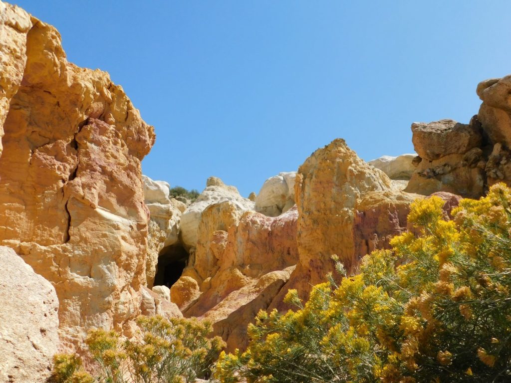
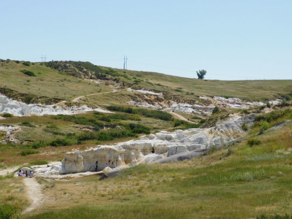
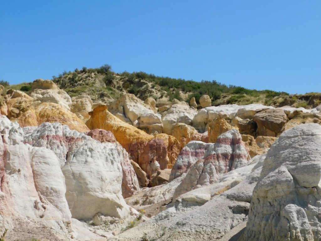
There’s some cool geology on display at Paint Mines Interpretive Park, operated by El Paso County on the plains of Colorado, about 35 miles northeast of Colorado Springs. Colored bands of clay, about 55 million years old, are sandwiched between white sandstone layers. Erosion has shaped the landscape into a badlands of hoodoos and spires. The different colors of clay are striking, but many photos on the internet appear to have been aggressively photoshopped to accentuate the effect.
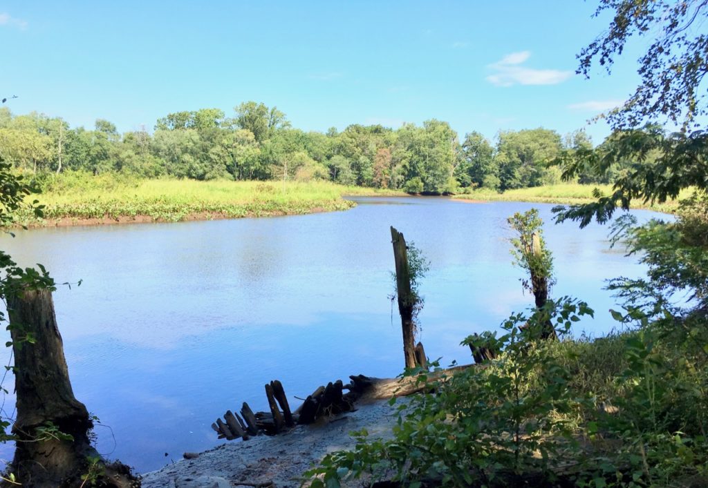
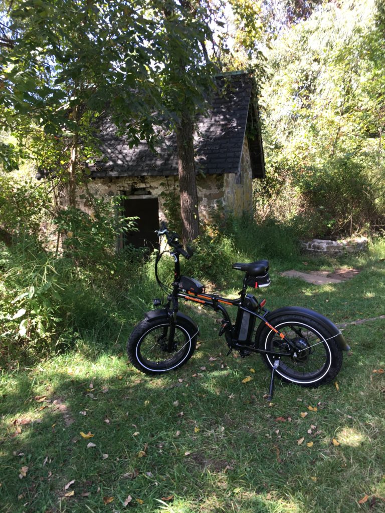
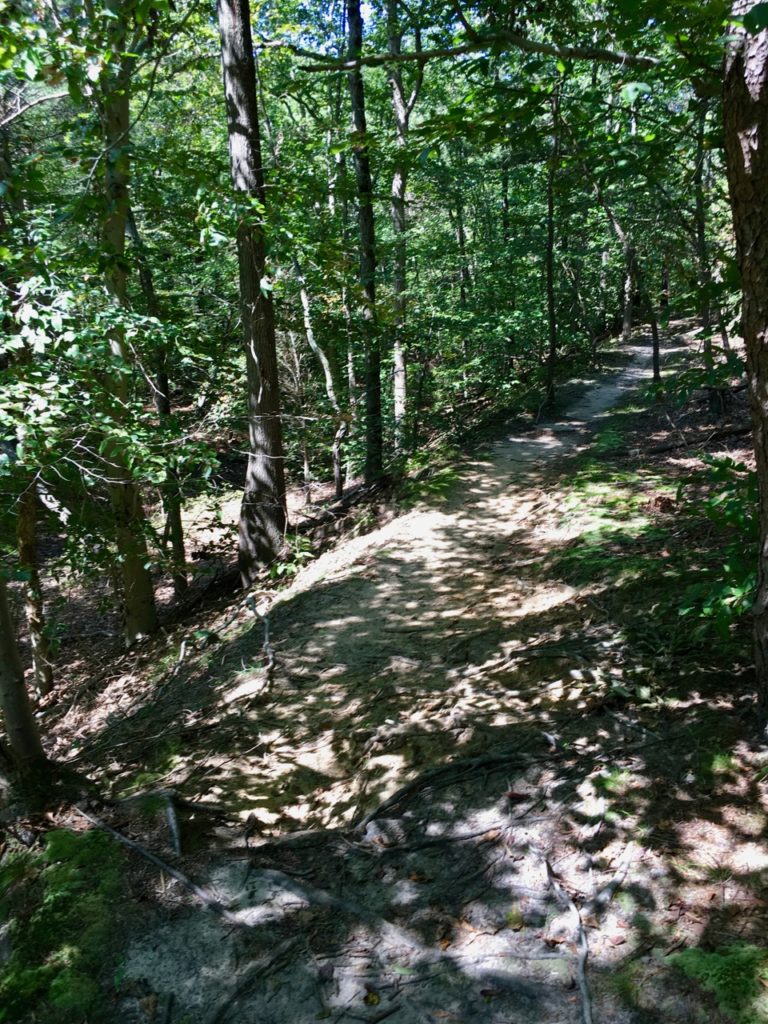
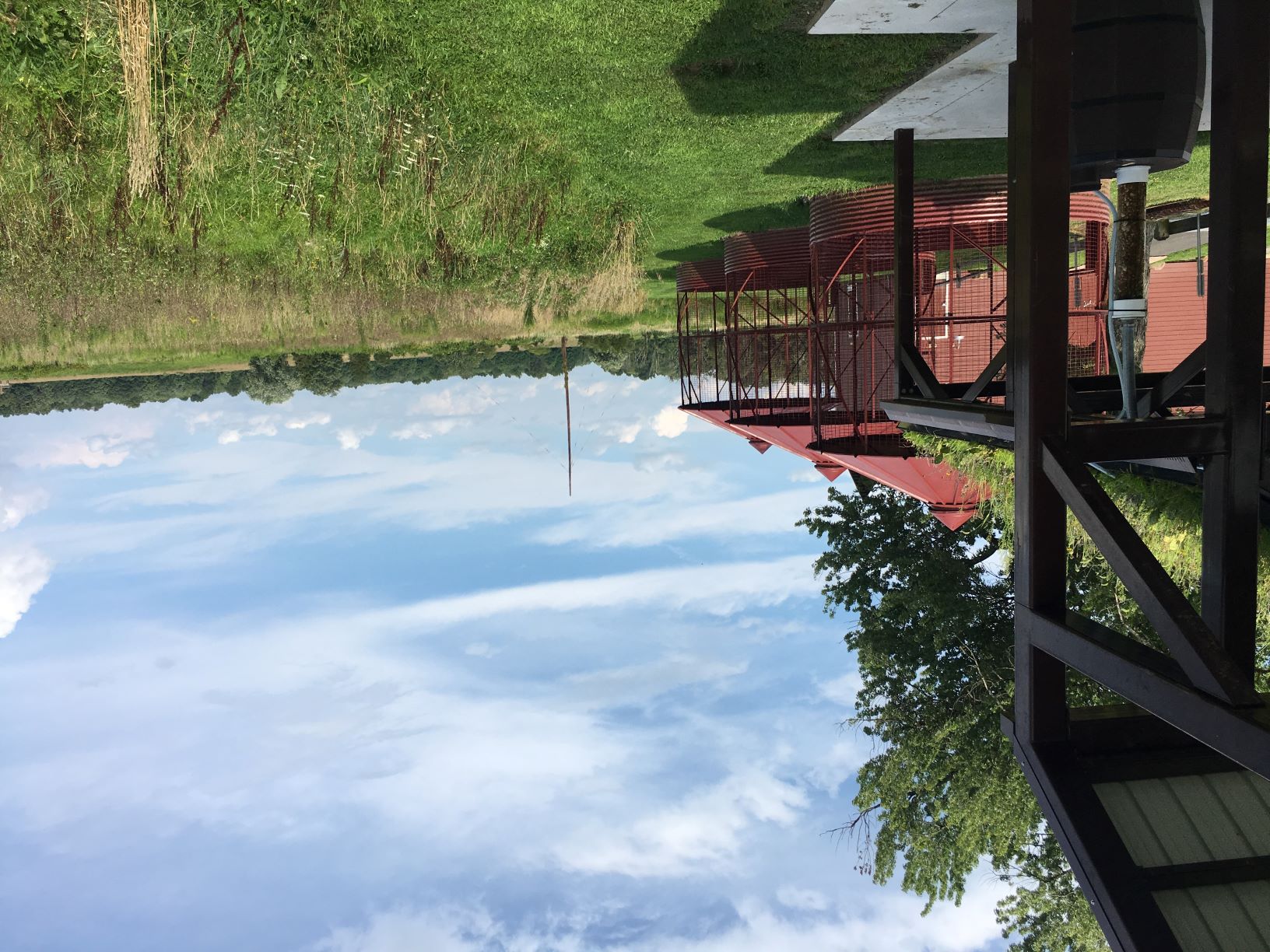
Rancocas State Park is in Burlington County, New Jersey, where the North and South branches of Rancocas Creek meet to form the Forks of the Rancocas. A Lenape village was formerly located here and in the 18th century, agriculturalist Charles Read owned the land. More houses were built in the 19th century, but in the first decade of the 20th century, much of the land was mined for sand, permanently altering the landscape and likely destroying any archaeological remains. Some ruins survived to the present, and trees and other vegetation now cover the scars from mining.
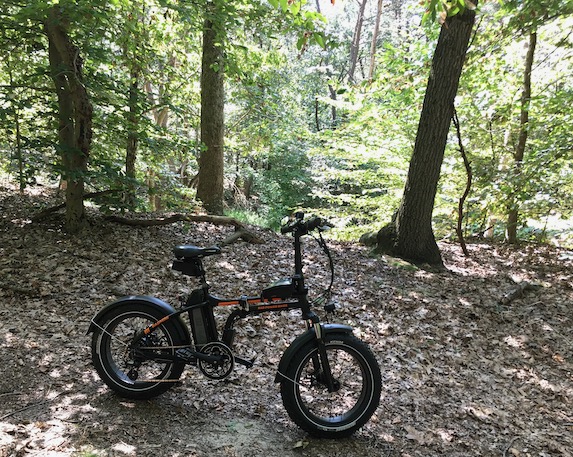
My Radmini e-bike had no trouble with the trails, which includes loose sand, packed sand, lots of roots, a little bit of mud, and the occasional log.
Whitesbog is where, in 1916, Elizabeth White and Frederick Coville produced the first commercial crop of blueberries. Before that, Whitesbog was a cranberry farm, and before that, it was part of the Pine Barren’s bog iron industry. It’s now part of New Jersey’s Brendan Byrne State Forest and sand roads surround its cranberry bogs.


From Outside Online, Two Locals Share their Favorite Hikes in New Jersey.

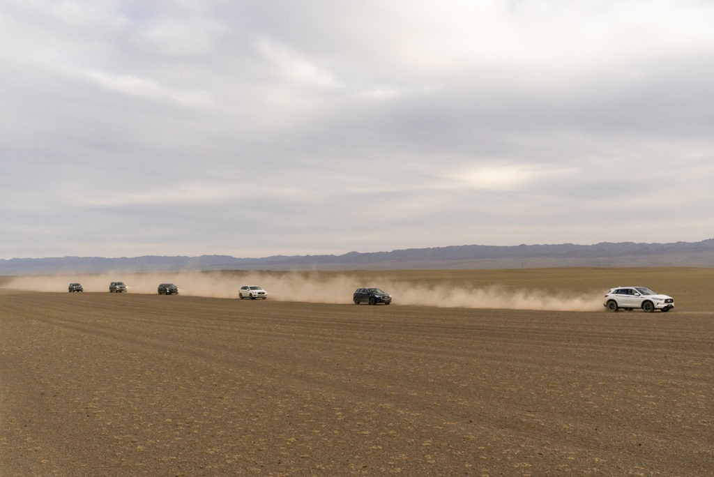
The Explorers Club, Hong Kong Chapter (which for no real reason immediately brought to mind the Flying Elvises, Utah Chapter) and the Mongolian Institute of Paleontology and Geology (IPG) recently teamed up for a twenty day jaunt into the Gobi Desert to look for dinosaur fossil and to commemorate the 100th anniversary of Roy Chapman Andrews’ Central Asiatic Expedition.
Point of order here: On his trip to Mongolia one hundred years ago, Andrews was actually working as a spy for the U.S. Office of Naval Intelligence during World War I. His more famous Central Asiatic Expeditions, where his team from the American Museum of Natural History made so many important paleontological discoveries, including the first dinosaur egg fossils, began in 1922.
That 1918 mission did result in valuable information that helped make his later scientific expeditions to Mongolia so successful – including his conviction that a motorized vehicle expedition was feasible.


The original telephone system connected phones by copper wire strung up on poles. These “land-lines” faced a problem when confronted with obstacles like the Atlantic ocean, so it was not possible to connect the phone systems of distant countries. In the 1920s, AT&T developed a way of using short wave radio to transmit telephone signals over long distances without wires. In 1928, AT&T bought several farms in Lawrence, New Jersey, cleared the land, and began building a vast antenna array for trans-Atlantic telephone calls. The facility, officially called the American Telegraph & Telephone International Radio Telephone Transmission Station, was only responsible for calls originating in the United States. A separate facility in Netcong, New Jersey, received incoming calls from overseas.
The Lawrence station became known as the Pole Farm because the rhombic antennas that AT&T installed at the site were arranged in a diamond-shaped pattern on wooden poles up to ten stories tall. Each antenna covered 10 acres and connected New Jersey and the rest of the U.S.A. with a single city in Europe, North Africa, the Middle East, or South America. Hundreds of these poles were arranged over the 800 acre facility. Open areas between the poles were leased to farmers, who had to plow around the many antennas.
Fewer than 50 calls were made on an average day in 1929, in part because a three-minute call to England cost over thirty dollars. The station, however, allowed almost instantaneous communication across the Atlantic Ocean (once trained telephone operators had arranged the connection). By the 1960s, however, international calls were more affordable and over 16,000 telephone calls were transmitted daily through the Pole Farm.
The Pole Farm shut down in 1975, replaced by undersea cables and satellites. Where once there were hundreds of wooden poles, there is now only one. That pole, which once transmitted phone calls to Israel, survived because the farmhouse next to it used it as a lightning rod.

Two buildings, imaginatively named Building One and Building Two, bracketed the antenna field. Both buildings have been demolished, but a memorial to the facility, built over Building One, includes a large concrete and stone map set into the ground, showing the layout of the antennas around the time of World War II. Each antenna is labeled with the city to which it transmitted phone calls.

The Pole Farm is now part of the Mercer Meadows county park and features restored grasslands, nature trails, and interpretive signs.
Reference:
Yearley, Alexandra
2013 “Pole Farm” remembered in Mercer Meadows plans. https://communitynews.org/2013/02/01/pole-farm-remembered-in-mercer-meadows-plans/
The Adventure Cycling Association and other groups are developing a bicycle trail along the route of historic Route 66.
Stephanie Garber owns an RV park in Carthage, Missouri, along USBR 66. Although most of her customers arrive in motor homes or towing campers, so many cyclists now pass through that she created tent camping spaces specifically for them.
But making the route suitable for cyclists was no small task, and choosing the roads to include on the route meant balancing safety, tourism, and history. In addition to assessing factors like traffic volume and speed limits, staying close to the original highway and its Americana was paramount.
See the rest at Get Your Kicks Biking Route 66